Thursday, April 24, 2014

Snowshoeing Pikes Peak

Spring Snowshoe Trip to Pikes Peak

We pay our $10 each and 30 minutes after leaving the driveway we're up the Pikes Peak Highway and along the side of the old ski area, ready to strap on the snowshoes

Young firs are starting to fill in the ski trails.  The electric wires connect to Glen Cove.  Shirley breaks trail.
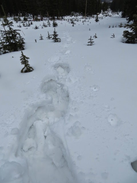
The snow is deep and wet with a thin crust over a lot of granular ice crystals which makes for some slow going.

After a turn to the east, Glen Cove is behind us with Little Italy full of snow--but, no skiers.

To the north, the lowlands are snow free.

We continue to the top of the ski area, into the Bristlecone forest and my favorite individual.  It has just a couple of live branches on the right side.


Pikes Peak is shrouded...

but overhead, patches of blue.

 On our way down we take a few minutes to look at apparent NFS born again fire mitigation efforts along the highway.  Is this a fire break?

  Some sort of micro clear cuts with piles of skinny logs and slash.  Hard to guess what's going on other than a hell of a job of "management"


Sunday, April 13, 2014

Spring in Red Rock Open Space

Rock-fall in Red Rock O. S.

It's an overcast, spring morning and, of course, there are deer.
On a bike ride, last week,  I passed, at least, 40 of the flora-munching domestiques. 

 The upper lake, once dry, is now a  muddy-shored body of water.

Then, coming into the climbing area, I notice a recent rock slide.  Similar to one that happened on the other side of the canyon last year.

Since I am on an amble I take one of the several side trails in the SE part of Red Rock.


 These are social/game trails that are untended, eroded, interesting and "illegal".

It isn't too far along that I come upon another dislodged chunker.


But, it's further down in this canyon where I find a big one.  About the size of a family van, this one is on the trail, which is on the right.


Ya gotta wonder when the geology is more active than the wildlife.


Started Outstanding

Started out standing & wound up on my face

It started out as a late March trail jog.  First tracks in the snow.  But, it's not cold and it's Spring!

So, about once a year I take a faceplant on the trail.  It's always on the flat and I just trip on some little protrusion and go down.  Usually, just a little road rash on the palms and knees.
Not this time.


For some reason I just didn't get the hands out and took it on the nose.
Thank God, no one was around and I was close to the car so I didn't pass anyone.
Saddest part, I tripped either on this same spot or within about 30' a couple of years ago.
Still, a rough day on the trail beats....just about everything.

Friday, February 14, 2014

Monarch Pass Back Country Ski

Top of Monarch Pass in January

Up the Old Monarch Pass Road.  Notice the blue sky?--not a cloud all day.

Lacking snow on the top of the Divide, but who cares--notice the blue sky?

Top of the pass

We decide to do a pit to check snow conditions.  Here one can see a pretty thick depth of consolidated snow on ice grains.

There's those ball bearings that make Colorado backcountry dangerous.


We  descend moderate slopes.  Did I mention the cloudless skies?

Sunday, January 12, 2014

Crystal Lakes Back Country Ski

Francie's Hut and Beyond
Clear, warm & windy
Crystal Peak

8" of new snow--not Prius conditions on the road in to the trial head.

No problem for the 4WDs and we're off.

First ski of the season and it's about a perfect day.  Our end point for the day is to the right of the point above Shane's head.

Past Francies hut there's great snow in the trees but "considerable" avalanche potential

So, we play it safe and stick with the snow that is 2" deep and hard as a rock.

Did I mention wind?
We're at about 12,400, 4.8 miles along/2,100' gain and on the saddle E of Peak 10 with a view of Breckenridge ski area (not in photo).

Had some crusty turns and a bit of fine powder on the way down.

And we're back where we came from.


Tuesday, December 3, 2013

Blodgett Peak Open Space

Blodgett Peak up and back

160 acres at the NW corner of C. S. in this poor photo of the trail head sign.

 It's a beautiful October 20


The trail suffered only a little from the floods.


After a mile the trail leaves the valley and heads straight up.


The incline moderates as we reach the saddle and begin to see evidence of the Waldo Canyon fire.

Kind of a grim landscape just below the summit.  Even the rock surfaces are spalling  from the heat.

The view from the Blodgett Peak summit, 9,423', looking NW toward Rampart Reservoir shows the extent of the burn.

  Life goes on...


Found at the edge of the fire zone next to the trail.


Saturday, September 21, 2013

After the Rain

Mother Nature, reminding us whose boss.


I start at 31st and Kiowa where the creek, usually dry, comes down through Pleasant Valley.


Then it's over to check out Fountain Creek next to Highway 24.


Then down the trail to 26th St. but not continuing under the bridge.


A few days later I hike the Section 16/Palmer Loop which is in pretty good shape and the little trickle of a creek is flowing nicely.


Shirley and I venture up High Drive.  No matter how much gravel you pile on.....


 This is a serious road rut.


And, this is just a plain old washout.


Can't say they didn't try.


The water is paying no attention to the little check dam at the top of Bear Creek Canyon.


This morning I take a ride up to check out Gold Camp Rd. which is closed.

Another good day to be above ground.


My kind of road.


Ride on...


Even the first tunnel has a stream running through it.  But, the best part is the sound of the water in the tunnel.  Because of the echo it sounds sort of like distant traffic noise but with more consistent with very subtle, constant changes in pitch.


Here is the washout that will keep Gold Camp closed for awhile.  Bushwhack it, no problem.


Upper Helen Hunt Falls--check out the Rooster Tail!


Coming down High Drive is like riding in a river bed--maybe it is.


Back on a single track, social.  Humm, no erosion.


And, on down a recently designed/built trail.


This temporary lake even has some ducks who seem very happy mucking up the weeds.


Did I mention--autumn is in the air.