Wednesday, September 13, 2017

Tetons/Eclipse 8/21/17


(just a note about working on this blogging platform, Blogger, IT SUCKS! )

Between 8/12 - 8/23/17 we traveled north to Gros Ventre campground east of the Tetons to experience the total solar eclipse.  It went well.


On our way north we often overnight at the Afton Wyoming "homestead" of one of our extremely generous friends.  No, the crab apples weren't blossoming in August, this is from an earlier trip.


Our home for the week, the Gros Ventre campground, is huge.  Over 300 sites and, according to my bike computer about 5 miles of loops.  Being tenters at heart we stay in the no generator section.  Also, because we don't have a generator.

Some of us are happier with our accommodations than others.


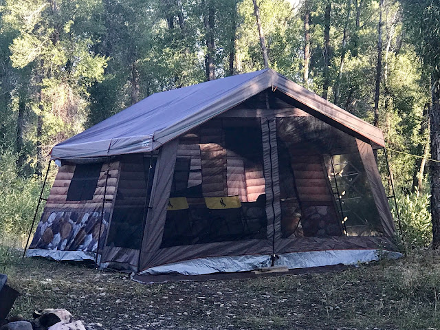
The range of set ups is always amazing.  A log cabin--who'da thunk it!
Yeah, huh?


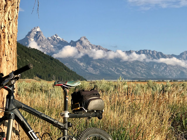
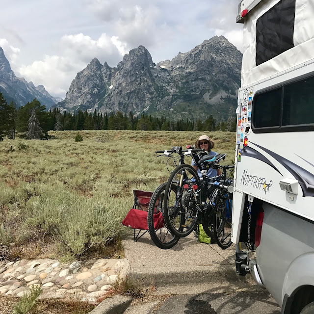
Morning bike ride from the camp site along Mormon Row road to view--the Tetons!

OK, so I'm not the first to take this photo.  But, I had to do it.


Having fun on String Lake, but not us.
Birthday paddle in Leigh Lake, accessed by a portage of about 20 rods from String Lake.

They only missed 1 year, because of fires.
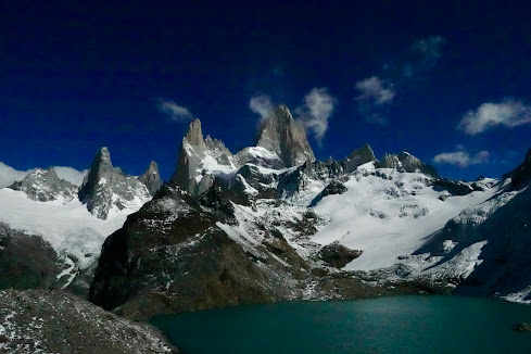
The geography is diverse, from alpine hikes
to high plains, sagebrush paths
and sitting in cactus patches.

Lunch at a scenic overlook.  Everyone else is at the visitor's center.


So, the big day arrives (best photo, ever!)  

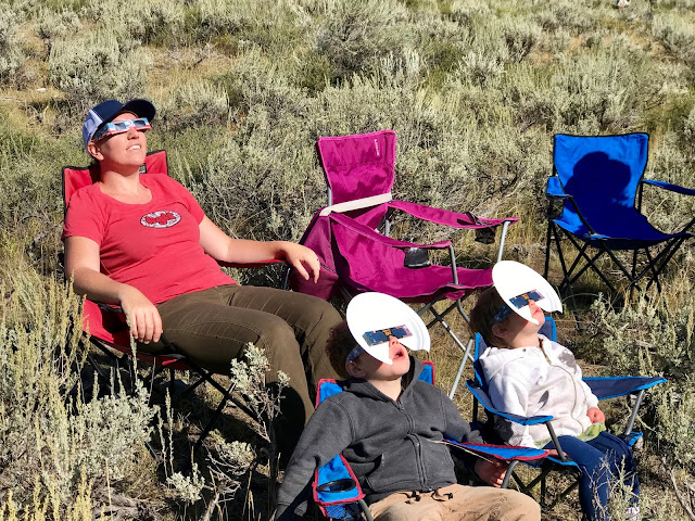
On go the jackets.  No crowd here


The moon commences it's inexorable course
Crescent shaped flecks of light mirror the progress of the eclipse


(the I-was-there shot) The temperature drops, a dark shadow sweeps down from the Tetons at 1,000 miles per hour, a deep twilight engulfs us and we witness a benign natural phenomenon something like viewing the rings on Saturn or seeing a full, double rainbow.  The surface of the sun is around  11,000 F but the corona, now visible with the unprotected eye, is 1,000,000 degrees +.  After 2 1/2 very fast minutes a bright "diamond" appears at the upper right corner and on go the glasses.
We return east through some beautiful scenery until Dubois then it's flatland
until the Snowies where we like to camp before the descent into I-25.


Tuesday, September 12, 2017

Ice Lake 9/7/16 - 9/9/16


Late summer trip to the south San Juan mountains to hike up to Ice Lake.

On the way southwest from Colorado Springs to the Silverton area we overnight on the south rim of Black Canyon of the Gunnison.

Very nice even though Montrose is not far to the southwest.


We took advantage of evening daylight to walk some of the rim.

Humm.....


Pegmetite intrusions in Painted Wall.  Abstract dragons and Park logo on the upper left.


Camping at the trail head and hiking the red line to Ice Lake


Falls from Ice Lake at the side of the trail up gives a preview of the mineral content of the water.

Above timberline just before the view down to Ice Lake.

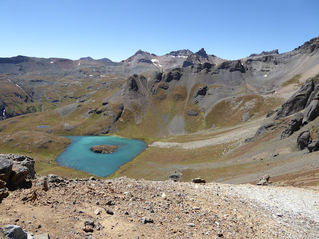
Preternaturally blue Ice Lake at the base of a craggy, San Juan ridge
Contrasting lakes from above and south of Ice Lake

Island Lake north and above Ice Lake, greener and incredible beautiful
Extra credit saddle hike above Island Lake (trail on the right)


View from saddle above Island Lake


Plaque at the saddle.  Happy to have survived my little hike.  Just do it!


Saturday, February 25, 2017

Bens Portugal 12/31/16 - 1/3/17


After our Christmas holiday on the coast, Shirley, Twila and I travel several miles inland to a very small village near the boarder with Spain -- Bens.

Small roads and green grass.

Cork tree after harvest.  The red paint is the date of harvest.  Cork is big in Portugal.

Our lodging:  2 bedrooms w/ private baths and combined kitchen, dining and sitting area.  Great view of the sunset -- $45/night.


Except for the few streets, the village is stucco houses and walls.


A recent public improvement project--wood fired, community oven.


We spent most  of two days walking north and south along an abandoned railroad that passes next to Bens


The north end originates at the Sao Domingos mine.  A tremendous ruined copper mine.  We are the only ones walking through this environmental mess that stretches for more than a mile.  On the map, above, it appears as a beige line extending up from the red circle.

To the south it's more pastoral and includes several small, collapsed bridges, a crumbling tunnel and this fairly impressive, long abandoned stone structure.  In this direction, the railway ended at the Rio Guadiana,  several miles past where we turned around.


15 minutes west of Bens is the historic town of Mertola first inhabited by the Phoenicians a few hundred years BC. followed by, among others, the Romans, Moors and Christians.  The main attraction was the Rio Guadiana which, eventually runs along the border with Spain and connects to the Atlantic.

Considering this little town is quite off the beaten path it's history is varied and deep.

Since 1960, when the Sao Domingos mine began to close the population declined from over 20,000 to less than 8,000.

From the hill top fort looking east, over the oldest mosque in Portugal, now the Church of the Assumption of Mary, to the Rio Guadiana and bridge that takes us to Bens.

The castle with a modern, above ground cemetery in the foreground.


Between the mosque/church and the fort/castle are the ruins of an Islamic village--on top of a 5th century "Episcopal Palace!"

Mertola has several small museums but our time was limited and constrained by the weekend and Monday--all times when public places are closed.


The displays we did see are simple but nicely done.

Finally, not all southern Portuguese residences are stuccoed as is demonstrated by this somewhat random, full-on tile facade along the main street of a small village.


Friday, February 10, 2017

Logos Portugal 12/23 - 12/30/16


Preliminary disclaimer regarding devices:  early on I lost my iPhone which I use a lot for photography and GPS,  didn't have the right charge for my actual camera and, finally, burned out the charger for my toothbrush.  So.........

Itinerary:  Landed in Faro, drove south to Lagos and stayed for a week of beech fun and cliff walks, drove northeast to Bens (pronounced Bensh) for a few days of rail-to-trail walking, then back to Faro for the trip home.


Our Mediterranean-style vacation home in Lagos.  Yes, that is our car and the Atlantic a couple of blocks in the background!
Did Santa wear a wet suit?


Decorative palm trees?


Bird of Paradise with Hibiscus in the background--our yard!


Rallying around an old almond tree at one of the cliff-walk trail heads.


But, we're here for beaches, quaint white and red towns and really tall evergreen trees with perfectly laid out branches.

___________________________________________________________________________________

We have our surfing beaches

Our nonsurfing beaches


And, no beaches at all.


No end of beach walking opportunities:

mega kite

why?


We logged many miles along the cliffs:

Cliff fishing--never saw one pulled up, over the rocks.  But, as mentioned by a fellow observer that's why it's called "fishing" not "catching"


Grotto boat rides weren't operating because of the time of year and weather.  But, the on-shore viewing is exciting enough.


Fossil hunting


Marked trail through the dunes

Downtown Lagos gave us the red carpet treatment.  On the search for pizza.


It seems like midwinter is the height of orange season.  Now I know where Harry and David might get their citrus.  Every orange we bought was better than the best we get in the US, cheap and seedless.  Both of our lodgings had an electric reamer!

Spiderboy on the Parque Aventura ropes course in Lagos

Cats of a feather...


 Biology
Very nice, understated, unidentified orchid

Big, old agave plants.  Turns out to be an introduced species.

Coastal succulents

Misc.

Another small, unidentified winter biological treasure!